See how BNGAI simplifies biodiversity compliance for local councils.
Automated checks against the DEFRA metric
High-risk application flagging and monitoring
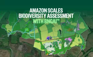
Satellite-powered land analysis for off-site credits
Validate with ease
BNGAI™ is an advanced platform that leverages AI and satellite imagery to simplify biodiversity net gain (BNG) compliance for local councils. Designed to handle increasing application volumes, automate plan validation, and provide real-time insights, BNGAI™ empowers you to ensure accuracy, efficiency, and environmental sustainability across all your projects.
Safeguard the future
With tools to support local nature recovery strategies, habitat banking, and biodiversity improvements around road networks, BNGAI™ enables smarter, faster decisions that promote long-term ecosystem health.
Conduct comprehensive ecosystem assessments to inform local nature recovery plans. BNGAI™ helps develop strategies for enhancing species recovery and ecosystem health.
BNGAI™ is an AI-powered platform that helps local councils and developers manage biodiversity net gain (BNG) compliance using satellite data and automated assessments.
BNGAI™ simplifies the review and validation of BNG plans, identifies at-risk projects, and supports the creation of local biodiversity plans and off-site BNG credits.
Get a demo
Streamline biodiversity net gain (BNG) with satellite imagery and AI — saving time, reducing costs, and ensuring compliance.
Sign Up
User created successfully!
Verify Your Email Address
Please check your inbox and tap the link in the email we've just sent to: