Make every site count with satellite-powered biodiversity insights
Whether you’re evaluating brownfield plots or unlocking greenfield potential, BNGAI™ by AiDASH helps you make informed land decisions—quickly, clearly, and with full confidence in your biodiversity outcomes.
Why Biodiversity Net Gain (BNG) matters for land professionals
BNG isn’t just a post-planning box to tick. It’s now a baseline requirement in England—and one that can shape land value, viability, and design feasibility.
With mandatory 10% net gain now in force, buyers and planners are under pressure to understand how a site performs—ecologically—before the first drawing is done.
BNGAI™ gives you the clarity you need to make those calls early.
What you can do with BNGAI™
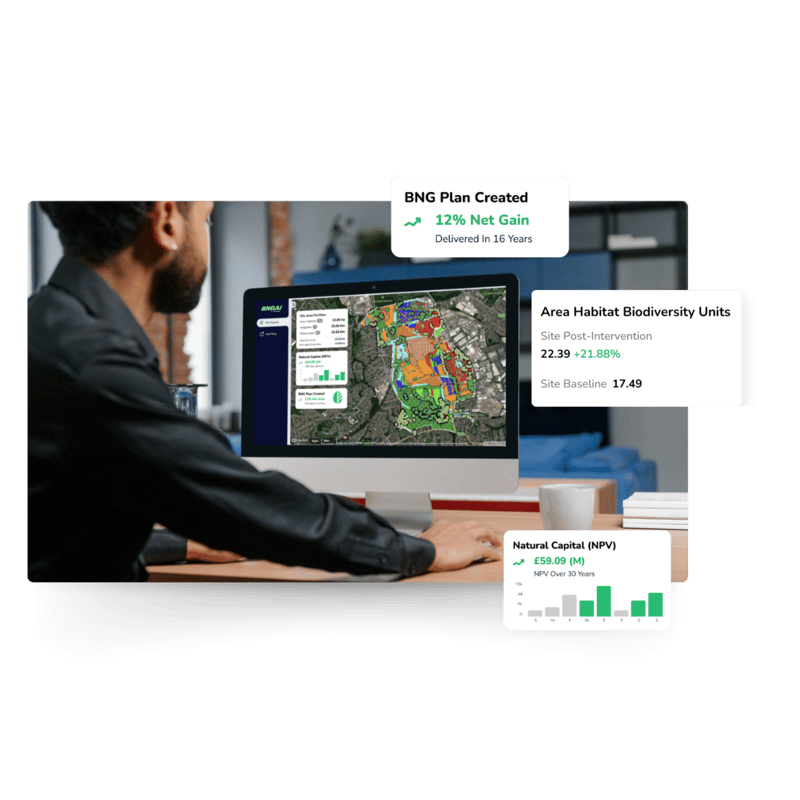
BNGAI™ is an and-to-end platform that leverages AI and satellite imagery to simplify biodiversity net gain (BNG) compliance for developers. Automate compliance, reduce risk, and meet BNG targets without slowing down development.
Assess BNG feasibility instantly
Upload your redline boundary and generate a full biodiversity baseline aligned to the statutory Defra metric.
Avoid costly surprises
Spot risks before they derail deals—habitat constraints, hedgerows, watercourses, and strategic scoring are all accounted for.
Run uplift scenarios
Test different layouts and enhancements to see which option delivers the required uplift with minimal disruption.
Protect your GDV
by calculating compliance costs and integrating them into your financial strategy.
Monitor portfolio-wide impacts
to ensure sustainable practices and compliance across multiple projects.
Getq submission-ready reports
Get metric summaries, habitat maps, and reports ready to feed into planning.
Make informed land acquisition decisions, protect your GDV, and simplify BNG with BNGAI™.
AI-optimised land acquisition with minimal impact on your GDV
Compliant BNG plans with automated assessments and tools
Portfolio-wide monitoring for sustainable returns
How it works
1
Upload or draw your site redline boundary
2
Let BNGAI™ automate your site analysis
3
View and export your BNG baseline in 3 days
4
Run uplift scenarios and create BNG plans
Achieve compliance, protect your returns
BNGAI™ helps developers navigate biodiversity net gain (BNG) requirements effortlessly.
Make informed land acquisitions, integrate compliance costs into your strategy, and streamline approvals with an all-in-one platform designed for developers.
Why land professionals use BNGAI™
With tools for compliance, biodiversity offsets, and project-wide enhancements, BNGAI™ empowers land owners and developers to make informed decisions that balance growth with sustainability.
De-risk land acquisition decisions
Speed up pre-app assessments
Support early design feasibility
Identify opportunities for on-site uplift
Reduce project delays caused by late-stage BNG changes
BNGAI™ is an AI-powered platform designed to help developers streamline biodiversity net gain (BNG) compliance, leveraging satellite data and automated tools to simplify planning and decision-making.
Yes, BNGAI™ is built to handle multiple projects simultaneously, offering real-time insights and data-driven support for portfolio-wide biodiversity management.
BNGAI™ provides accurate baseline assessments, automated habitat classifications, and ongoing monitoring to ensure compliance and sustainable development outcomes.